View Vehicles
It is important to be able to see what is getting done in the field. The map module will help you get a bird’s eye view.
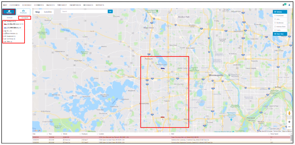
The map displays your vehicle and employees’ location with overlays such as geofences and jobs.
View Vehicles on the Map
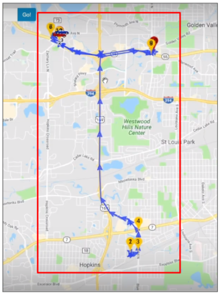
Vehicle track uses hard-wired GPS tracking devices assigned to your vehicles to locate them on the map. You will be able to see the location of each of your vehicles or all vehicles at once.
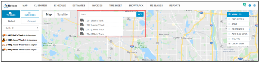
View an individual vehicle’s location by using the search bar or the vehicle list.
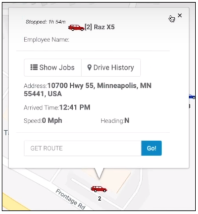
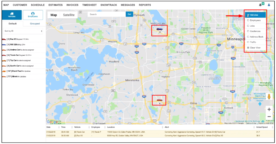
Click on a vehicle from the list to zoom in and see its exact location on the map. Click on the icon and a dialogue box will pop up above the icon.
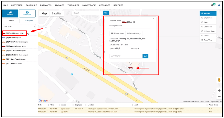
From the dialogue box, you can see the vehicle’s location, when it arrived at that location, its current speed and the direction where it is headed to. At the upper left-hand corner of the box, you’ll see how long the vehicle has been on its current state. You can also view the trail that your vehicle has taken over the past 24 hours. You can also get the route that your vehicle can take in getting to its destination.
View Vehicles according to vehicle groups that they belong to from the Grouped tab.
You can also search for a specific vehicle using the search bar. The search recognizes either the vehicle’s name or ID.

You can also do a search for vehicle types.
Click on Vehicles from the overlay and all of your vehicles will be displayed on the map. The vehicle ID will be displayed below the icon so that you know which vehicle it is at a glance. The vehicle icons will still be color-coded to depict the state it is currently in.
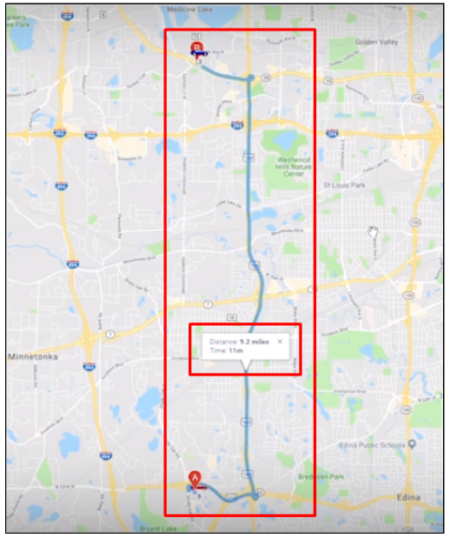
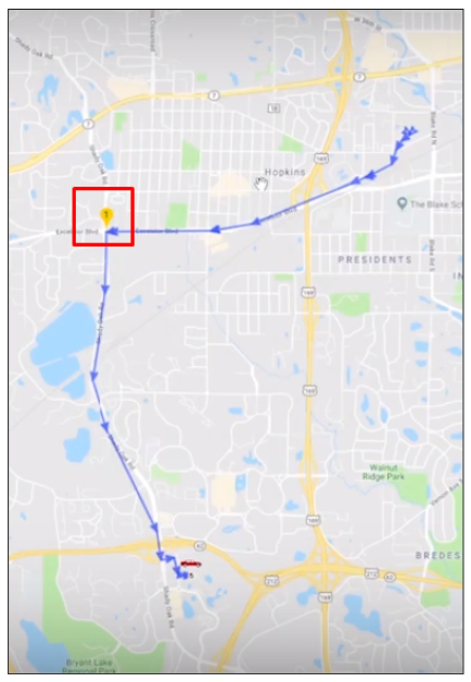
If you are doing any kind of live routing or dispatching, you can get the best route that your vehicle may take. Key in the destination address on the Get Route field and click Go.
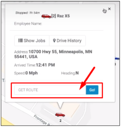
You will see on the map the best route the vehicle may take to get from its current location (point A) to the destination address (point B). The information will also include the total distance between the two points and the estimated drive time.
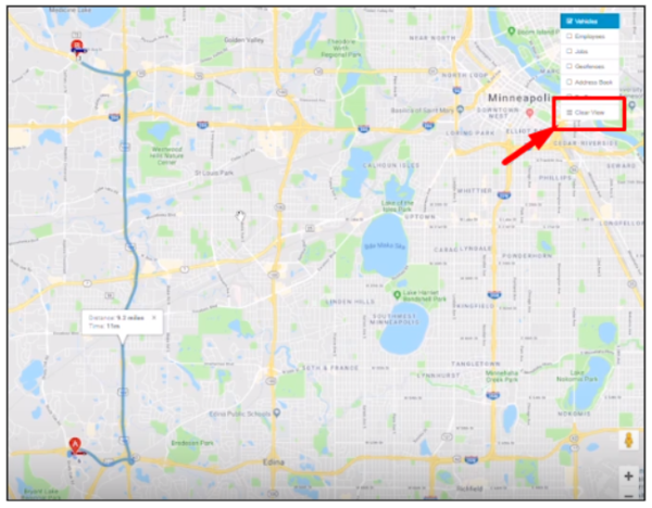
To remove the route from the map, click Clear View from the Overlays.
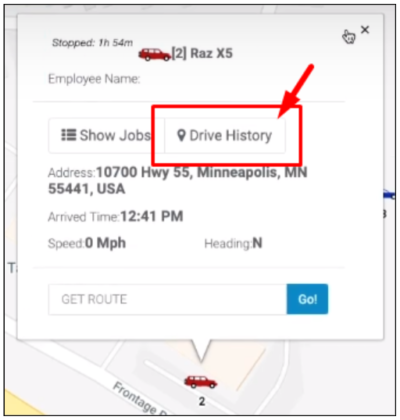
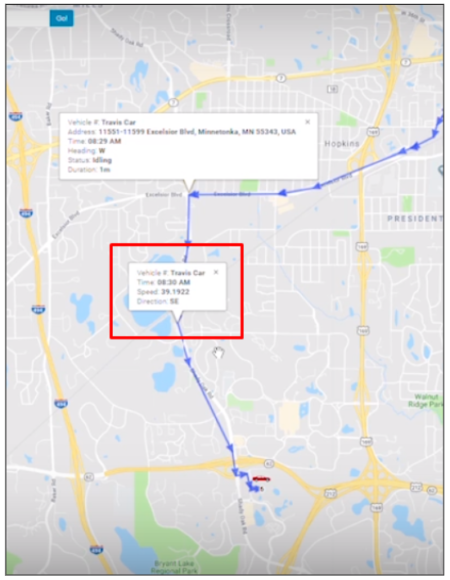
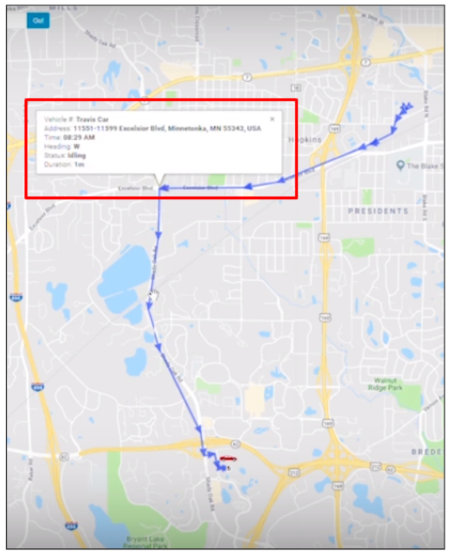
The Drive History will give you the trail everywhere the vehicle has been over the past 24 hours.
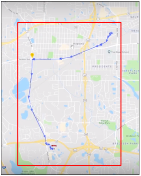
The balloon icon marks where the vehicle stopped or idled more than the allotted time specified in the report settings.
Click on the balloon icon and a dialogue box will pop up. This will give you the location where the vehicle stopped or idled plus the time when it occurred, its status and duration the vehicle was on that state.
Click on any of the arrows to see details on the vehicle’s speed at a particular time.